
HKUST's campus is dense and vertical - dozens of interconnected buildings, sky bridges, and multi-level podiums where the shortest way to a lecture theatre or lab is rarely a straight line, and rarely obvious from outside. Generic map apps can get someone to a building's front door, but they fall apart the moment a visitor needs to find a specific room, lift, or exit inside. HKUST engaged Beautitag Limited to build a purpose-made wayfinding app that understands the campus at the level of detail that actually matters: floors, corridors, and rooms.
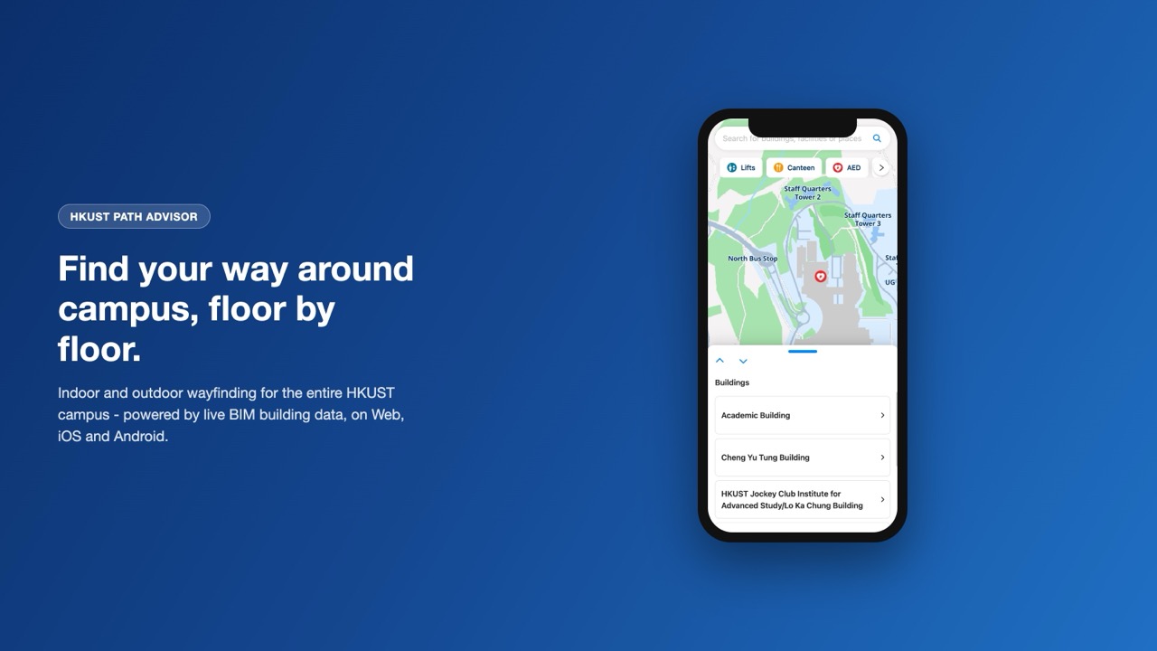
The result is HKUST Path Advisor, an indoor and outdoor wayfinding app available as a responsive web app and as native iOS and Android apps. At its core is a search-first map: users type a building, facility, or place name and get directions that blend outdoor routing across campus with indoor routing once they step inside a building. Quick-access filters surface commonly needed facilities - lifts, canteens, AEDs, and more - directly on the map, alongside a full directory of campus buildings.
The technical core of the app is its integration with HKUST's Building Information Modeling (BIM) data. Rather than maintaining floor plans and room labels by hand, Path Advisor fetches building geometry and facility locations directly from the university's BIM models, so its maps stay aligned with the as-built campus as buildings are renovated or added. Beautitag built the pipeline that translates this BIM data into a routable indoor map, layered on top of outdoor campus routing, so a single search can guide someone from anywhere on campus to a specific room, elevator, or accessible entrance.
The app is also built for everyday campus life without depending on connectivity - core navigation keeps working with no internet connection, which matters in basements and structures where signal is patchy. Since launching for the HKUST community on 1 September 2025, Path Advisor has become the university's standard tool for finding a way around campus - for new students during orientation, for visitors attending events, and for staff and faculty navigating buildings they don't use every day.
Key Features:
- Combined indoor and outdoor wayfinding across dozens of campus buildings
- Building and facility data sourced directly from HKUST's BIM models
- Search-first map with quick filters for lifts, canteens, AEDs and other facilities
- Core navigation works with no internet connection
- Available as a responsive Web app, and native iOS and Android apps
Access:
Web (Responsive)
Android on Google Play
iOS on App Store