
Space Management & Indoor Wayfinding
All Your Spaces.
One Interactive Map.
Put every campus, building, floor, and room on a single interactive map. Students find their way without an app, your estates team gets space records they can report on, and live IoT sensors show what each room is actually doing.
- No beacons, no app to install
- Imports the DWG/DXF plans you already have
- Deployed in weeks, not as a capital project
Wayfinding
Indoor Wayfinding Students Actually Use
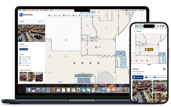
Turn-by-turn directions from any entrance to any room, across every building on campus - in a browser, with no app to install.
- Routes that respect reality - lifts, stairs, covered walkways, and step-free options for wheelchair users.
- Runs on the web, so a visitor scanning a QR code at the gate gets directions without downloading anything.
- Room, department, and facility search that understands the names your campus actually uses.
- Your own branding, buildings, and points of interest - not a generic base map with pins dropped on it.
Space management
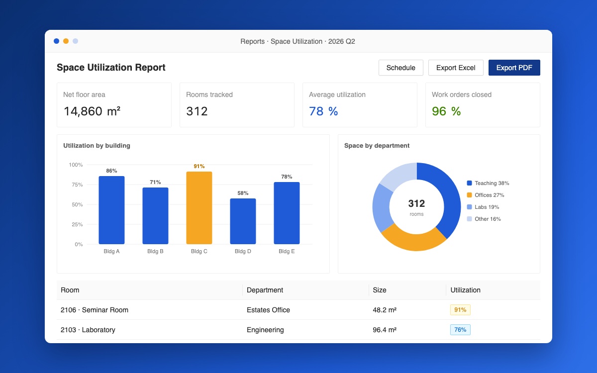
Space Data Your Estates Team Can Report On
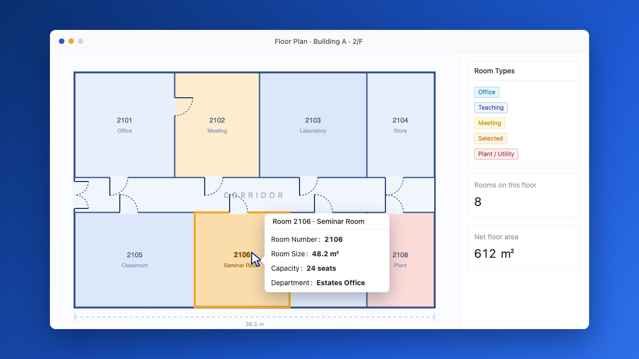
The same map doubles as your space inventory: every floor, room, and asset recorded, searchable, and ready to export the moment someone asks for numbers.
- A room register holding area, type, department, and capacity - the fields facilities and accreditation reporting keep asking for.
- Utilisation and space inventory reports exported to Excel or PDF in one click, or scheduled straight to stakeholders.
- Location-based work orders: technicians open the mobile map, see the jobs around them, and reach the right room first time.
- A lighter, faster alternative to legacy IWMS platforms, with local support in Hong Kong, Manila, and Cebu.
IoT
Live IoT Sensors on the Same Map
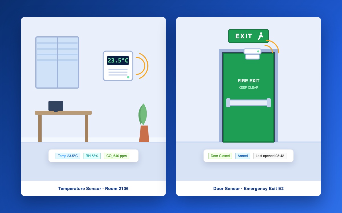
Occupancy counters, environmental monitors, and energy meters feed the map directly, so a floor plan stops being a drawing and starts being a live view of the building.
- Occupancy and people counting that shows which rooms are genuinely used, not just which are booked.
- Environmental and energy monitoring surfaced per room, per floor, and per building.
- Readings flow into the same reports as your space data, so utilisation arguments are evidence-based.
- Vendor-neutral: we integrate the sensors you already have, or specify ones that fit.
A Complete Toolkit for Map-Based Facility Management
From CAD drawings to live IoT data, everything your estates team needs lives on one map.
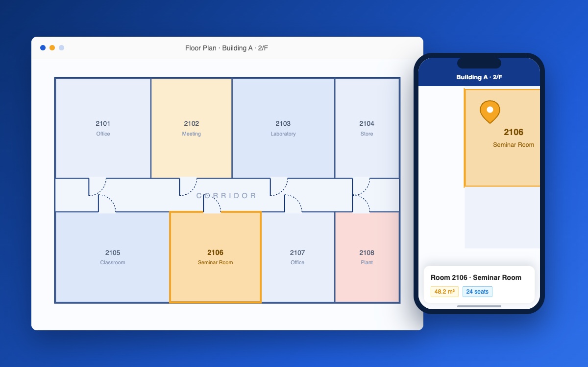
Interactive Map on Web and Mobile
Navigate your entire estate - campuses, buildings, floors, and rooms - on one fast interactive map. The same live view works in any browser and on any phone or tablet, so office staff and field teams always see the same picture.
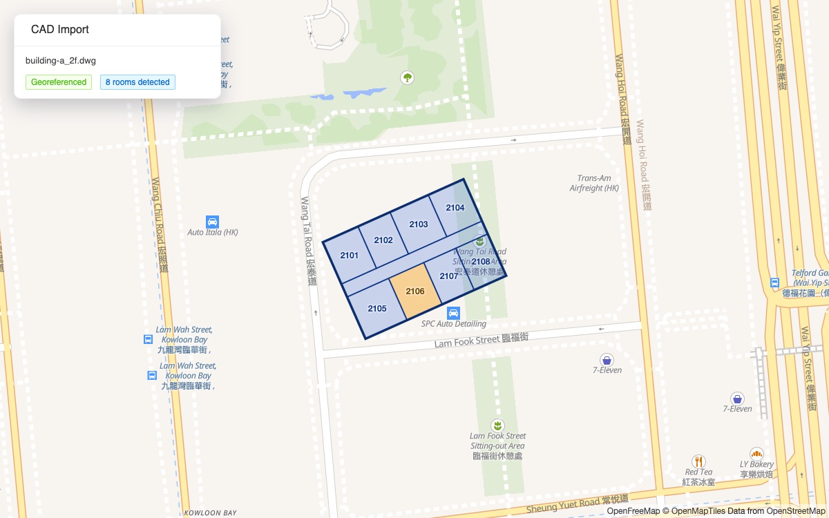
CAD Import with Georeferencing
Import the DWG/DXF floor plans you already have and georeference them onto the map in minutes. Your CAD drawings become live, clickable floors - preserving years of drafting work instead of redrawing it.

Work Orders Pinned to Real Locations
Raise, assign, and close maintenance work orders at their exact location. Technicians open the mobile map, see every job around them, navigate straight to the room, and update status on the spot - no paper trails, no wrong-room visits.
One-Click Reporting
Generate space inventory, utilisation, and work-order reports in seconds and export them to Excel or PDF. Scheduled reports land in stakeholders' inboxes automatically - audit-ready numbers without the month-end scramble.
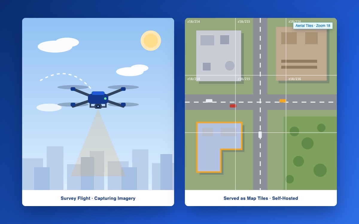
Aerial Imagery as Map Tiles
Bring real-world context to your spaces with aerial and satellite imagery served as fast map tiles. Overlay buildings and floor plans on high-resolution aerial views - self-hosted, so you stay in control of licensing and performance.
IoT Sensor Integration
Connect occupancy counters, environmental monitors, and energy meters from leading vendors. Live readings appear directly on the map and feed your dashboards and reports, turning static floor plans into a real-time view of your facility.
How It Works
Import Your Floor Plans
Bring in existing DWG/DXF drawings and georeference them onto the map, with aerial imagery served as map tiles for real-world context. Try our free CAD to GeoJSON converter to see your drawings on a map today.
Connect Your Operations
Link IoT sensors, room inventory, and maintenance work orders to their real locations, so live data and daily operations appear exactly where they happen.
Manage, Track, and Report
Teams work from the same map on web and mobile - dispatching work orders, monitoring sensors, and generating space and maintenance reports in one click.
Built for Every Kind of Estate
Universities & Campuses
Manage teaching space, laboratories, and student facilities across multiple buildings - with the space inventory records and reports estates offices need.
Offices & Commercial Buildings
Keep floor plans, maintenance, and sensor data in one place, and give building managers a live map view of every floor they operate.
Public Facilities & Venues
Coordinate maintenance teams across large sites with mobile map-based work orders, and keep every asset findable on an aerial view of your estate.
Now open
Founding Campus Programme
Five places for the 2026/27 academic year
We are working with a small number of universities as founding partners. You get the platform deployed on your campus at founding-partner rates, held for the full term, and a direct line into what we build next.
Apply for a PlaceWhat you get
- Wayfinding live for a building set you choose, plus your room register on the map
- Founding-partner pricing, locked for the full twelve months
- Fortnightly reviews with the team building the product - your priorities go into the roadmap
- A named engineer for your deployment, with support hours in your time zone
- An agreed upgrade path and price if you continue, set at the start so there are no surprises later
What we ask for
- A named sponsor inside the university who will carry the project
- Your existing CAD floor plans, in whatever state they are in
- Permission to reference the deployment once you are happy with it
Questions We Get Asked First
Do we need to install beacons, Wi-Fi hardware, or an app?
No. The map runs in a standard web browser and needs no beacons or additional hardware, which is why a deployment is measured in weeks rather than as a capital project. Blue-dot positioning can be added later if you want it, but wayfinding, space records, and reporting all work without it.
We already have CAD floor plans. Can you use them?
Yes - that is the normal starting point. We import DWG and DXF drawings and georeference them onto the map, so your existing drafting work becomes live, clickable floors. You can try the first step yourself with our free CAD to GeoJSON converter before speaking to anyone here.
How does this compare with an IWMS like Archibus or Planon?
Those platforms are broad, powerful, and expensive, and most institutions use a fraction of them. We cover space inventory, utilisation reporting, and map-based work orders, and we put wayfinding and live sensor data on the same map - which traditional IWMS platforms do not ship. We can also run alongside an existing IWMS rather than replacing it on day one.
Can it help with accreditation and facilities reporting?
It gives you the underlying numbers. Room areas, types, departments, capacities, and utilisation live in one place and export to Excel or PDF, so whoever compiles a facilities submission is pulling from a live register instead of rebuilding a spreadsheet. The submission itself is still yours to write.
How long does a deployment take?
For a defined building set, weeks rather than months. The timeline depends mostly on the state of your floor plans and how quickly the room register can be agreed - both of which we assess before quoting, so the date we give you is one we have actually measured.
Where is our data hosted, and can we get it out?
We offer regional hosting options and complete your IT security review before contract, not after. Your floor plans and space records remain yours, with a documented export path, and we will discuss source-code escrow if your institutional continuity policy requires it.
Ready to Put Your Campus on the Map?
Send us one floor plan and we will show you your own building running on the platform - no commitment, no procurement process.